Presentation of the Map of Formentera
The project has been produced by the BalearWeb group and on this occasion the work team has been strengthened by the architect Marià Castelló, regular collaborator for FormenteraWeb.
Coinciding with the production of the Map of Formentera, a direct access has also been incorporated from the FormenteraWeb front page to the special Green Circuits on Formentera with information and photographs of island paths that can be covered on foot or by bike. The Special, produced by BalearWeb, has also had collaboration from Marià Castelló.
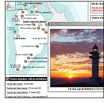
Photo: Partial view of the screen with the Map of Formentera
Datum: 18/11/2003
© 1996-2024 BalearWeb / Mallorca - Werbung - Kontaktieren Sie uns - Zugelassene Informationen - Zugänglichkeit