Part of Mallorca can now be seen via Google Maps Street View
Santanyí, Campos, Llucmajor, Marratxí, Palma...
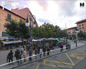
As from today, part of Mallorca can now be seen via Google Maps Street View. The municipalities included in this update go from Santanyí to Estellencs, covering all the area of Ses Salines, Campos, Llucmajor, Marratxí, Palma, Puigpunyent, Andratx and Calvia, as well as other small neighboring towns.
This allows a very detailed view of squares and streets as popular as the Plaça Rei Joan Carles I or la Rambla, both in Palma.
Related News
- Mallorca map update (04 Desember 2007)
- Interactive Map of Mallorca with Google's technology (29 October 2007)
Date of publication: 10/11/2009
© 1996-2024 BalearWeb / Mallorca - Advertising - Contact - Legal note - Accessibility